Arctic air set to arrive
We’re just a week into September and the first cool spell of autumn is poised to arrive.
After a weekend of heavy, thundery downpours for many, there’ll be a brief window of drier weather on Monday. However, as an area of low pressure sweeps through on Tuesday, Arctic maritime air will quickly follow on behind.
Whilst a cool spell at this time of year is nothing unusual, it will certainly remind us that as the hours of daylight reduce and the sun doesn’t reach as high in the sky, it can start to feel noticeably colder.
Falling temperatures
The most noticeable trait of the Arctic air’s arrival will be the significant drop in daytime temperatures. By midweek, they will be 4-6C below the average for this time of year – peaking at 12-16C north to south, and the coolness exacerbate by a brisk and blustery north to northwest wind.
What will make this cool spell feel even more pronounced is that daytime temperatures by Wednesday will be around 10C lower than they were at the end of last week, when the mid-20s were recorded widely, and some parts of western Scotland reached 27C.
The nights are expected to be chilly, with temperatures widely dipping down into single figures for most. Towns and cities will typically drop to 5-8C, but in sheltered rural areas, temperatures could get within a few degrees of freezing, with a touch of frost possible.
Snow over Scottish mountain peaks
After rain sinks southwards on Tuesday, the theme for the following few days will be sunshine and heavy showers.
Due to the wind coming from the north or northwest, showers will be heaviest and most frequent across Scotland, Northern Ireland and the northwest of England and Wales.
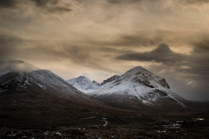
With the presence of Arctic air, the showers are likely to fall as sleet and snow over the tops of the mountains in Scotland. This isn’t anything unusual for September and happens relatively often. Nevertheless, it’s a reminder for hill walkers that we are entering the time of year when wintry weather will need to return to their radar.
How long will it last?
The cool spell is going to persist for most of us until Friday. Thereafter, westerly winds will return, bringing cloud, rain and milder air off the Atlantic Ocean.
This means that temperatures will gradually lift back to average for the weekend, albeit with a more unsettled theme.
Into next week, the current trend is for wetter weather and low pressure to be focused towards the north and west of the UK, and drier weather and high pressure towards the south and east.
What about the rest of September?
Towards the middle of the month, there are signs that high pressure may become the more dominant driver of the UK’s weather.
However, there’s still quite a bit of uncertainty about exactly where high pressure will end up sitting in relation to the UK.
If it doesn’t end up sitting right over us, this would mean that some areas on its periphery could still be experience unsettled weather.
There’s also the possibility that Atlantic hurricane activity could pick up, which would introduce even more uncertainty in the forecast beyond next week.

